

As Tropical Storm Hone advances toward Hawaii, the state is bracing for what could be a significant weather event, particularly for the Big Island. This storm, currently positioned southeast of Hilo, is expected to strengthen over the coming days, with meteorologists forecasting that it might escalate into a Category-1 hurricane by early next week. This development has triggered a series of warnings and preparedness efforts across the region as residents and authorities work to mitigate the storm’s potential impacts.
Forecast and Meteorological Insights
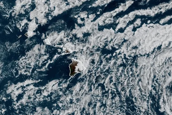
The Central Pacific Hurricane Center and other meteorological agencies have been closely monitoring Hone’s trajectory and development. As of the latest updates, the storm’s center was approximately 425 miles east-southeast of Hilo and 485 miles east-southeast of Kailua-Kona. It has been moving westward at a speed of 16 mph, with maximum sustained winds of 50 mph, and gusts reaching even higher speeds. The storm’s wind field is broad, with tropical-storm-force winds extending outward up to 115 miles from its center.
Meteorologists predict that the storm will continue to intensify as it approaches Hawaii, likely reaching hurricane status by Monday morning. The primary areas of concern include the Big Island, particularly its windward side, which is expected to bear the brunt of the storm’s impact. Heavy rainfall, estimated between 8 to 16 inches, is anticipated in these areas, with lower amounts of 1 to 2 inches expected in leeward regions. This heavy precipitation raises significant concerns about flash flooding and mudslides, especially in regions with steep terrain.
In addition to the rainfall, strong winds are expected to pose a substantial threat. Gusts between 60 to 80 mph are likely in the mountains and southern parts of the Big Island, which could lead to widespread power outages and further complications in affected areas.
Preparedness and Community Response
In response to the impending storm, the Central Pacific Hurricane Center has issued a series of warnings, including a tropical storm watch, a flood watch, and a red flag warning. These alerts are aimed at ensuring that residents and visitors take the necessary precautions to protect themselves and their property from the storm’s potentially severe impacts.
Local authorities have been proactive in urging the public to prepare for the worst-case scenario. This includes securing homes, stocking up on emergency supplies, and staying informed about the latest developments through official channels. Public safety officials have also emphasized the importance of avoiding unnecessary travel during the storm and heeding evacuation orders if they are issued.
The flood watch, in effect through Monday, highlights the risk of flash flooding in areas prone to heavy rainfall. Residents living in low-lying or flood-prone areas are particularly encouraged to be vigilant and ready to evacuate if conditions worsen. The potential for mudslides adds another layer of risk, especially in regions with rugged terrain where the combination of heavy rain and loose soil could lead to dangerous landslides.
The red flag warning, issued for North Kohala, South Kohala, Ka‘u, and the interior of the Big Island, underscores the risk of wildfires due to the combination of strong winds, dry conditions, and low humidity. These areas, already experiencing moderate to severe drought conditions, are particularly vulnerable to fires, which could spread rapidly under the right conditions.
Authorities have advised against any activities that could spark a fire, such as using open flames, grilling, or parking vehicles on dry grass. The memory of last year’s devastating wildfires, which caused significant damage on Maui and the Big Island, is still fresh, adding urgency to these warnings.
Environmental and Agricultural Concerns
The Big Island is currently experiencing a range of drought conditions, from moderate to extreme, depending on the area. The windward side, where much of the heavy rainfall is expected, is in moderate drought, classified as D1 on the National Weather Service’s drought monitor. Other parts of the island, such as the Mauna Loa slopes, are in more severe drought conditions (D2 and D3).
This disparity in rainfall distribution across the island creates a complex situation. While the anticipated rain could provide some relief to drought-stricken areas, it also poses the risk of exacerbating wildfire conditions in regions where the rain is less likely to reach. The Kona coffee belt, which is in its rainy season, is particularly at risk, as any heavy winds without accompanying rainfall could increase fire hazards in the dry terrain.
The agricultural sector is also on high alert. Farmers, particularly those in the Kona coffee belt, are concerned about the potential impact of the storm on their crops. High winds and heavy rains could damage coffee plants, which are particularly vulnerable during this time of year. Additionally, flooding could affect other agricultural areas, leading to potential crop losses and soil erosion.
Long-Term Implications and Climate Considerations
The approach of Tropical Storm Hone is a stark reminder of the increasing frequency and intensity of tropical storms and hurricanes in the Central Pacific region. Climate change is believed to be a significant factor in this trend, as warmer ocean temperatures provide more energy for storm development. This year has already seen a number of powerful storms in the Pacific, and experts warn that such events could become more common in the future.
For Hawaii, this means that the state must continue to enhance its preparedness and response strategies for tropical storms and hurricanes. This includes investing in infrastructure that can withstand severe weather, improving emergency response systems, and ensuring that communities are well-informed and prepared for potential disasters.
The state’s unique geography and environment also mean that the impacts of these storms can be particularly severe. From flooding and landslides to wildfires and agricultural damage, the range of potential hazards is broad, requiring a comprehensive approach to disaster management.
Conclusion
As Tropical Storm Hone approaches, Hawaii faces a critical test of its preparedness and resilience. With the storm expected to intensify, the Big Island is likely to experience significant impacts, including heavy rainfall, strong winds, and the potential for flash flooding and mudslides. The added risk of wildfires, particularly in drought-affected areas, further complicates the situation.
Residents and authorities are taking the necessary precautions, but the storm’s unpredictable nature means that the coming days will be crucial in determining the extent of its impact. As Hawaii navigates this latest challenge, it serves as a reminder of the broader climate trends that are shaping the future of weather patterns in the Pacific region. The response to Hone will not only address the immediate threats but will also provide valuable lessons for managing the increasing risks posed by tropical storms in the years to come.